
Alouette Mt.
- Jocelyn Timmermans

- Apr 17, 2025
- 3 min read
Updated: Apr 19, 2025
April 16, 2025 -- Golden Ears Provincial Park
Stats: 13.6 km / 1160m gain / 1196m high point / 6 hours MT
This is the route you should not take. I would never do it again, this early in the season. But the scenery was beautiful and it was a most memorable day.

At the West Canyon parking lot, there were orange ribbon barricades and a bit farther there was an orange plastic fence, stating that the trail was closed and more than one bridge was out. The trailhead to the Evans Peak trail is just a hop & a skip from the West Canyon trailhead. But we somehow managed to miss it. Later when we exited there, we asked ourselves, "How could all five of us have missed it?" We came to the conclusion that it was Irene's fault. She tripped on a root and banged her knee on a rock while skirting round the barracade. We were so distracted by her misshap that we weren't watching our surroundings. She is one very stoic woman, going on to complete the whole very challenging loop. Not once did she complain.

I forgot to download the route onto my phone the day before and my Garmin map page is finicky. It's small and if the cursor isn't in the middle of the screen when you zoom in & out, you end up losing the track. We ended up turning onto the Evans Valley trail, not the Evans Peak trail.


When the trail entered this boulder slope in which Evan's Creek flowed, there were not many markers anymore. We had to rely only on our GPSs. We stayed left (after doing the right side that dead-ended) and headed straight up towards the Golden Ears Ridge.


The Edge Mt (1440m) -- north.


Looking back towards Alouette Lake. We turned a bend where the snow started at about 950m.


We climbed up the gully to the left. The right one was even steeper! The snow was hard so our micro-spikes gripped well. As the grade got steeper, we had to do a lot of kick stepping. Usually three quick thrusts into the snow with the toe of our boot.

This photo gives you a realistic image of how steep the slope was.

About 2/3 way up the gully I parked myself on this nice big flat rock to wait for the others. I was beginning to get worried about Brigitte. Just minutes before, she was beside me but on the other side of the gully while I opted for climbing up the intermittent patches of rock. So where did she go??? Then I heard a bunch of voices. I called back to them but didn't get a response. I thought I'll give it a few more minutes and then start to descend. It was a very welcome sight when Irene showed up in the distance. Soon they all were gathered at my rock. Brigitte had slipped but because the snow was getting soft, she didn't slide too far. She was more concerned about losing her phone. As she began to ascend once again, she saw something glittering in the sun on the edge of the dirt. It was her phone!

Beyond the big rock it wasn't near as steep but the snow was getting soft so we were post-holing almost every other step and getting pretty tired.


Once we crossed the creek (thankfully the snow-bridge didn't give way), we saw footprints where our GPSs determined the trail to Alouette Mt was. Climbing the remaining 124m to the summit was not an option. We'd have needed to traverse below an avalanche slope and we were exhuasted (even Brigitte).

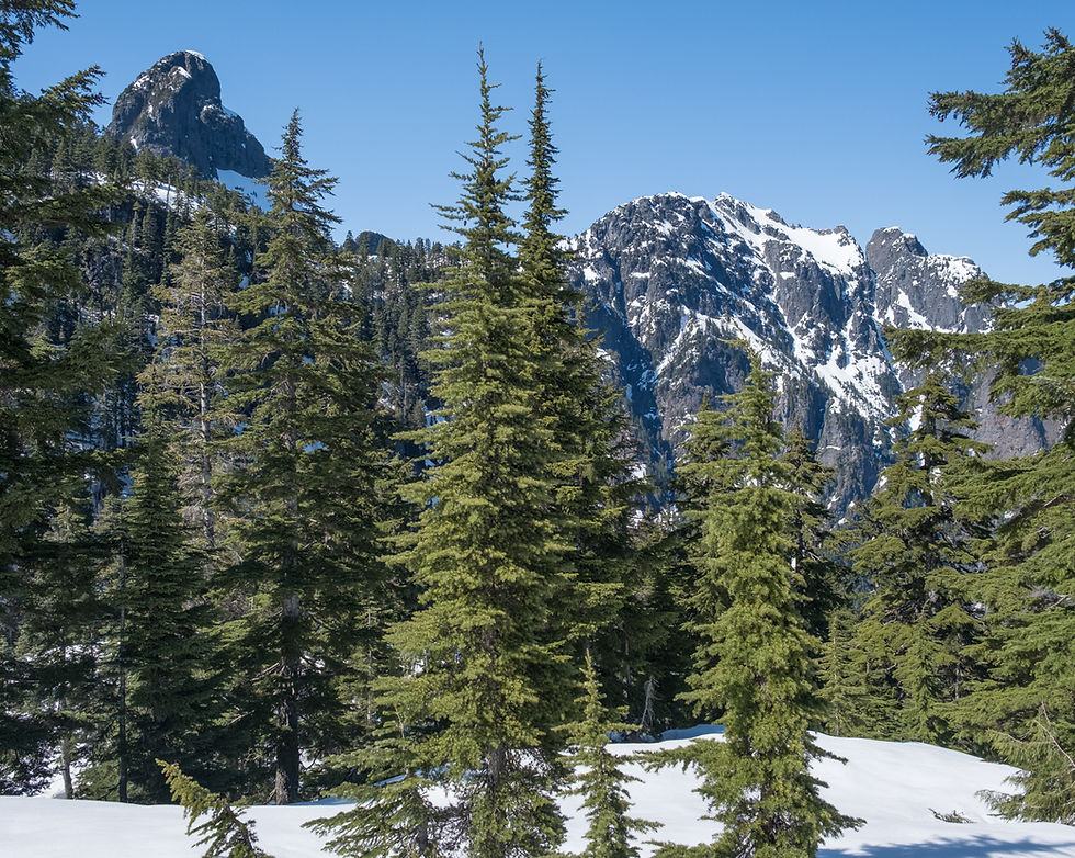
Golden Ears Mt. (1620m) is tucked in behind Edge Peak.

Blanshard Peak to the left.

Judge Howay -- northeast.

Robie Reid

Group shot: Brigitte G, Sue A, Irene H, Denise D + me

Starting the descent on the East Alouette route.


At the junction to Evans, which had been our original plan. Beyond that we were on familiar territory.


Roots, roots and more roots on another steep trail.


At the only flat part of the trail, looking at Evans Peak (1080m).


We regrouped at the junction turning left on the Viewpoint trail which was blessedly flatter. Not one of us could claim that our knees were not hurting.


Crossing the creek, we soon connected with the West Canyon trail, which got us to the parking lot within minutes. We'd started our hike at 9:45am and returned at 5:00pm.

We did this loop counter-clockwise.


Comments