
Cougar Divide Trail
- Jocelyn Timmermans

- Oct 17, 2025
- 2 min read
October 14, 2025 -- Mt. Baker Wilderness
Stats: 14.4 km / 934m gain / 2103m high point / 5:40 hours MT
Winter descended overnight. We were just able to drive 20 km on FSR 33 to the trailhead (1485m) and that's where sparkling fresh snow started to cover the ground. One more snowfall and that won't be possible anymore this year. None of us knew about this trail till Owen did it the week prior. It runs parallel to the more popular Skyline Divide trail which is not accessible by vehicle since the 2021 flood. This hike was a beauty and definitely one we'll revisit.

We had our micro-spikes on 100% of the time.

It didn't take long and we had views of Mt. Baker and all the many surrounding peaks.


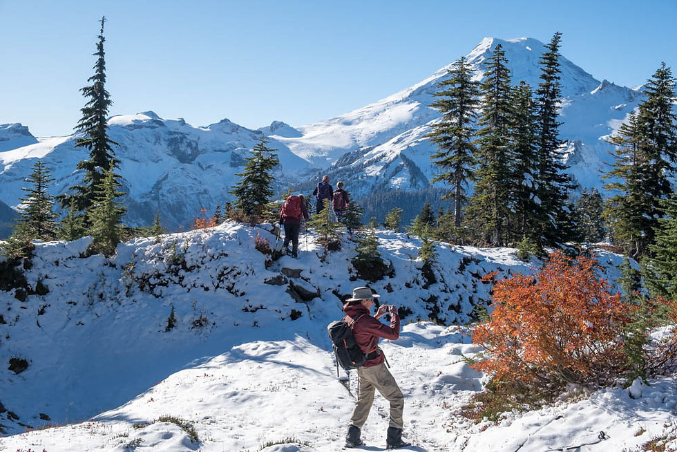
There were still a few fall colors but past their prime.


There were about six large fallen trees we had to clamber over.


north

south

Above the tree-line, still on the Cougar Divide trail.

Church, Tomyhoi & Larabee Peaks -- north.

Chowder Ridge -- southwest.

After a bit of a dip, we began the ascent on this wide open slope. Just past this point where Janet is standing, is where AllTrails showed that the Cougar Divide trail stopped. Then it angled left towards Chowder Ridge. We agreed to stop in the cluster of trees to the left, according to plans.

Hadley Peak to the left with Mt. Baker peeking out behind Chowder Ridge -- southeast.

The Skyline Divide Ridge -- west.


As we were enjoying our snack at the cluster of trees, our eyes were lured to the footprints that led higher up the slope. Once regrouped, I asked if anyone wanted to continue? The majority did which turned this from a moderate to more challenging hike.

The Cheam Range on the center of the horizon -- north.

Mt. Shuksan to the left. Patterns in the snow shaped by the wind. Thankfully this day (unlike the previous day) had no wind.

northeast


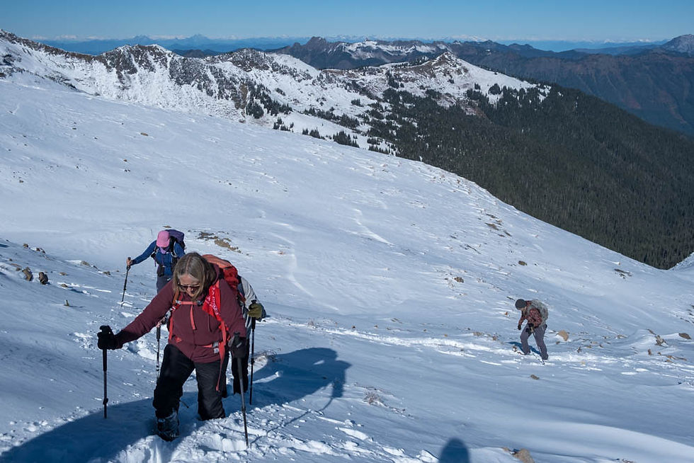
There were pockets of snow that were knee deep but it was ankle deep for the most part.

Shuksan & Hadley Peaks -- east.


If this extremely steep icy section wasn't so close to our destination, I would've turned around. But we all made it up and down without falling. John & Karl, who were ahead of me, made it look easy.

Wow wee!!! What a view!

Shuksan & Chowder Ridge -- east.

southeast

Mt. Baker -- south.

The Black Buttes right of Mt. Baker and Coleman Glacier to the right -- south.

The Pacific Ocean -- southwest.

Skyline Divide -- west.


Once on top of the ridge, we ascended a bit higher, turning right.

Hadley Peak (2277m) to the left.


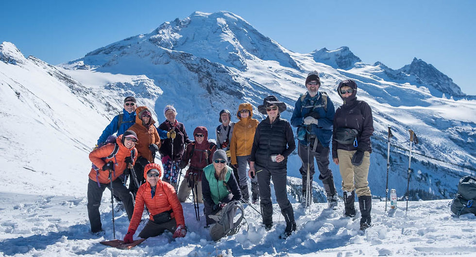
Group shot: L to R, back row: Patrick R, Denise D, Janet (guest), John Mc, Kevin D, Sari K, Karl V, me Front row: Cindy W, Sonja J, Sue A + Teresa K

Heading back down.


We met up with Irene H at the beginning of the Cougar Divide trail.


Table Mt infront of Shuksan.


Comments