
Mt. McGuire
- Jocelyn Timmermans

- Jul 17, 2025
- 2 min read
July 15, 2025 -- Chilliwack Valley
Stats: 9 km / 880m gain / 2119m high / 3:50 hours MT / 4x4
Some serious 4x4ing, a vast variety of brilliantly coloured wildflowers and 360 degree summit views, made for an outstanding hike.
How far would we be able to drive? This was a maiden voyage for my new (used) hummer. It, and Johnny's driving proved to be very competent on this rough-in-places FSR. Thanks Johnny for driving it (he said it was fun). At the end of the day my hummer bore some pin-striping battle scars, proof of its initiation into the world of true 4x4ing.


In the AllTrails reviews it stated that most 4x4s would not be able to get past this broken bridge. We were not "most".
We all piled out to wittness the tricky manouvers required to get up an almost vertical slope. Johnny & Owen really had to hit the gas to get the umph needed to get up this short stretch.

Good thing we got through that broken bridge because it cut off alot of FSR walking. We got to within a km of the trailhead. There were no signs or indication of where the road ended and the trail began. We had to rely on our GPSs.

Destination in sight.

An abundance of Indian Paintbrush lined the FSR.
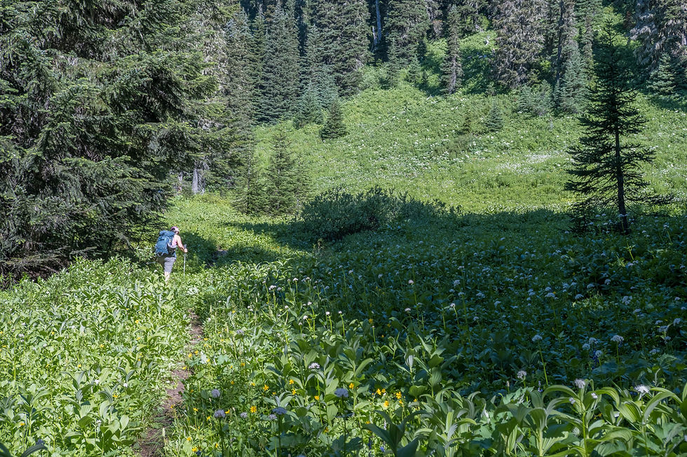
On the true trail.

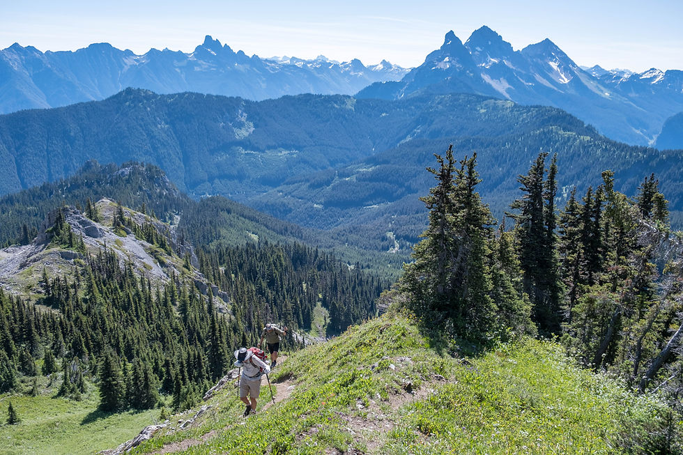
It didn't take long before we got these views of the Canadian & American Border Peaks, Larrabee and Tomyhoi -- southeast.

Low gear.

Slesse to the left.


The Cheam Range -- north.


The last stretch was quite steep and loaded with flowers.

The summit.


The Border Peaks, Tomyhoi and Shuksan -- southeast.
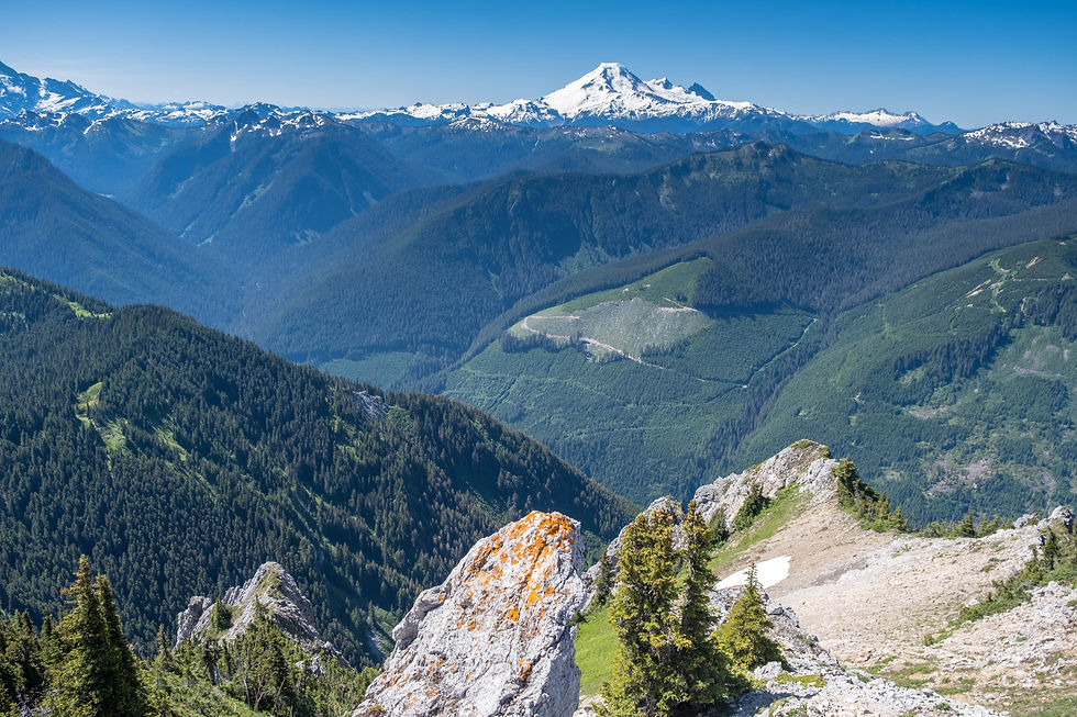
Mt. Baker -- south.

Chilliwack -- northwest.

Cheam Range -- north.

Slesse -- east.

There wasn't alot of wiggle room on the summit so we had to get cozy.
Group shot, back row, left to right: Owen W, Redina B, Iraj F, Johnny G
Front row: Sue A, Sue F, Brian H, Brigitte G & me


Stonecrop Matted Saxifrage

Beginning the slow very cautious descent.

Negotiating a sketchy exposed spot.


Provence Bellflower Arnica


Top pic: Mountain Agoseris Bottom pic: Daisy

Shrubby Cinquefoil


Alpine Pasqueflower Lupines


Thistle Tiger Lilies


Small-flower Penstemon Columbines


Monkey-flower


Cheers to another great adventure! Thanks Owen for organizing it.


From Chilliwack Lake Road, we turned right by a telephone pole on the left with the number 267 on it. Just a bit off of the road, a little yellow sign to the left, higher on a tree read: Borden Creek Road. I always download the route at home which came in very handy this day.


I will never forget coming down McGuire the hard way, It was so steep, thankfully there was lots of snow as I cartwheeled down, scared the dickens out of my fellow hikers, Lovely pictures.