
Mt. St. Benedict Loop

June 4, 2026 -- Mission
Stats: 11.5 km / 855m gain / 1282m high / 4 hours MT / 4WD
Unfortunately the views at the summit were not to be. Those clouds stubbornly stuck to the Mission mountains. John said this was his very first hike with the club 26 years ago and they had to turn back before the summit due to bad weather. This was his second attempt and once again unsuccessful. Nevertheless, at the end of the day we all agreed it was a time well spent.
David led us up and over the mountain, on a trail all of us had never done before. It was the kinder way to descend, after the paragliders' launch anyways.
The Murdo Creek FSR was pretty rough in spots, making the 4WDing more fun. There's no way you could get to the higher trailhead with a 4WD. This cut off an hour of climbing through the forest.
It took us just over half an hour to get to McKay Lake. The slippery wet boardwalk was held together with bycicle chains.


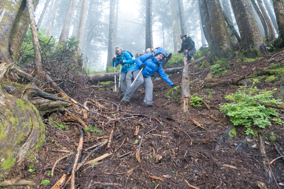
The slope past the lake was very steep. Thankfully there was no more snow on it. We had to scramble over several logs and high step over roots.

Just below the ridge the first patches of snow appeared.

Orange Jelly Elderberry

A small tarn.

Heather

At the top.

Group shot, back row, L to R; Elizabeth B, Danny G, Patty S, David G, Denise P, John Mc
Front row: Natalia B, Teresa K + me

This is one of my photos from a former hike, just to show you what the view would've looked like. Robie Reid + Judge Howay -- northwest.

Only about 5 minutes back down the trail we came up on, we branched off to the right on a trail that was new to all of us except David.

The first half an hour or so, it was a steep descent on a rougher trail.


I asked John to move away for my photo and look what he did! No wonder my camera didn't want to focus on him. lol

This was Danny's first hike since December when he severely broke his arm. We asked him why he chose this hike???
Red-belted Conk Bunchberry


Coming up the north-facing slope felt like wet and cold winter, whereas going down the south-facing slope in the sun was more like summer.


Once we got to the paragliders' launch, we were off of the trail and onto the FSR which was much more easy going.

south

Hatzic Lake -- south

Stave Lake -- southwest

Battle scars.

We needed four bandages this day. And Elizabeth wrenched her foot on the FSR, nearing the end of the hike. Thankfully she could still walk on it.

Somewhat overgrown. There was quite a bit of bear scat on this FSR.

At this lower open section, David showed us the trail that led very steeply down (for about 300m) to Cascade Falls. They'd put an arrow made up of stones on the road.

Swamp area branching off of Stave Lake.

Stave Lake -- west.

Weeping rock.

The last 20-minutes of the hike involved climbing back up on the road we'd driven up on. Sweat dripping off of our faces, we were thinking, "Are we there yet???"

The cold beers went down well. Cheers to another good day on the mountains.


Comments