
Spencer Peak

November 19, 2026 -- Chilliwack
Stats: 17 km / 1065m gain / 16 m high / 5:15 hours MT
I need a record-breaker to break the tie on the two record breaking hiking excursions I organized this year. Back in the spring when we hiked Vedder Mt. starting from my home and this day there were 33 participants! Equipted with 4 walkie-talkies, a sweep and a leader, we all made it to the summit. What a beautiful, fun day it was. The views were hard to beat.
A special thanks to Mary who got the key for the gate and got permission for us to drive through and to Brian who did a recon to check the gate a few days prior. This was our last opportunity for the season, as they had started deactivating the road.

Thanks Mary for getting the key to the yellow gate the day before. When we got to it on the Tamihi FSR, it was open but a yellow sign on it read, "Active logging, do not enter!" We did. When we saw two men on the road with their huge logging machinery, Mary hopped out and talked to them. I was holding my breath, hoping they wouldn't turn us back. What a relief it was when they let all eight of our vehicles pass. They had started deactivating the road a few km before the original trailhead. My hummer had no problem negotiating the fresh drainage bars but the others had already parked. So we did too after Owen & I had driven through about ten of them.

Instead of going straight like we've done the past few years, we turned left (north) onto a new FSR that the loggers had built. This avoided a long section of hiking up large rocks. About 70% of this route is on a deactivated FSR.

The Canadian & American Border Peaks + Larrabee Mt -- northeast.

After turning round a bend on a level section of ground, we came to the end of the FSR and did a sharp right turn (north) which led us into old growth forest.
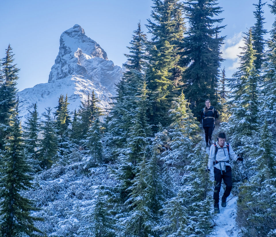
Up on the ridge it was quite frosty. Thanks John for adding flagging tapes at several junctions.

After checking out the amazing cabin which is at the rounded summit (1700m), it was just a hop & a skip to the open slope where the vistas were superb. The Cheam Range -- north.

McGuire - northwest.
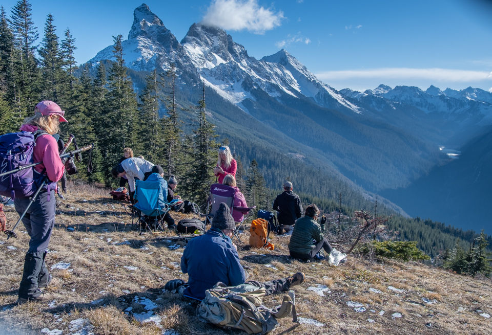
Getting settled in for a 1-hour lunch -- east. Tomyhoi Lake to the right.

Tomyhoi Mt (2164m) -- south.


Mt. Baker - south.

Group shot: back row, L to R; Joe K, Stelian A, Mike Ernst, Iraj F, Mary R, Jerzy M, Susan Anstett, John Mc, Owen W, Natalia B, Dawn L, Jos M, Patrick R, Lorenz B, Cindy W, Gregg S, David G, Jerry U
Front row; Karl V, Jodi Brown (new), Fred H, Irene H, Sue A, Brigitte G, Annet M, Karen S, Sheri K, Lori B, Marian Houde Carson (new), Brian H, Sonja L & Bubble, Michelle (new), me

Heading back.


east


Driving there, I was in front. Driving back, I was almost in the back. Irene & Fred were driving behind me. We weren't driving long before we ran into Patrick who had pulled over to the side to wait for us. Jerzy had just jumped out and started walking to Irene's vehicle to check if they had his hiking pole. I had a quick talk with Patrick & Joe before they started driving again. I was confused as to why they didn't wait for Jerzy??? Back at the Vedder dog park, I wasted no time in asking them why they left him behind. Apparently they thought he was sleeping in the back seat! lol


Another great adventure. Sorry I missed out, Once I get back in shape will join you.