
Julian Alps - Part 1

Sept. 1 - 9, 2026 -- Slovenia
Triglav National Park is Slovenia's only national park. It contains almost all of the Julian Alps. It's located in the northwest corner of Slovenia and takes up 3% of the country's surface. The small country (population over 2,100,000) has only 47km of coast along the Adriatic Sea.
When we had our briefing the day before we were to begin our 6-day hut-to-hut trek, we were rather taken aback when the man pulled via ferrata equipment from his bag. I didn't know we were doing that! The itinerary Book-a-trekking sent us, said it was a moderate trek. Not so. The booklet he handed to us from Lajf Inc. was much more detailed, stating the ratings of each individual day. The first 3 days were rated "difficult". After that the route stayed below 1800m and our via ferrata equipment was no longer necessary.
This trek is rated as slightly less challenging than the GR20 that we did in Corsica five years ago which is the most difficult trek in Europe. The Julian Alps route we did only takes second place because of the via ferrata making it safer. From June to August, there 's an annual average of 50 fatalities nationally of which most are concentrated in the Triglav area. There's about 150 annual SAR operations in the Triglav area of which 45% are not for injured hikers, but involve hikers that are lost, exhausted, stuck on exposed terrain or too frightened to continue.
This was Judith, Thea and mine fourth trek together, our first without Case. He really wanted to do this one. We missed him and thought of him often during the trek. Judith is Case's dutch sister and Thea is the mother of my son-in-law, Willem. She is the neighbour of Case's other sister, Janet. That's how our two children met. Many thanks to Judith for yet again organizing this trip.
August 31: I met up with Thea & Judith at Schipol airport in Amsterdam. We arrived in Kranjska Gora (valley) mid afternoon. After dropping off our luggage at the hotel, our taxi driver dropped us off at Lake Jasna. We had our briefing after dinner.

A view of the mountains we were to start climbing the next day.

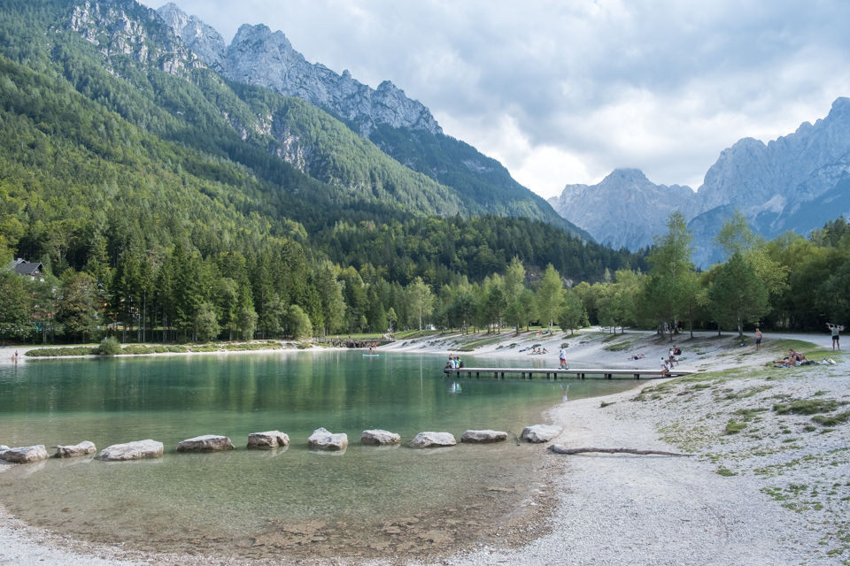


It was just a 30-minute walk back to our hotel.


We weren't too thrilled about learning we were to be doing via ferrata climbing. That meant exposure and extra weight to carry. My pack was 30-35 lbs. Why so heavy when we were going hut to hut and didn't neet more than a liner and pillow-case cover for overnight gear? Each day I started out with at least 2.5 liters of water. We were sweating throughout the day. But at night temperatures cooled off, especially in the alpines. I also had my camera gear, a second set of clothes, a winter coat, gloves, mits and a big bag of nuts and power bars. Each morning we took our plastic baggie along to breakfast and filled it with bread for lunch. Breakfast & lunch were paid for through the tour agency but not lunch.
Sept. 1: Planica to Vrsic
Stats: 9 km / 900m gain / 1688m high point
A wrong turn made this a more challenging day. The 6-day route basically went from north to south.

What would our next six days be like? What challenges would we have to face in those mountains? These thoughts went through my head as we took those first steps on a cool misty morning. We were dropped off at the Plancia parking lot after a 10-minute drive from our hotel.

The sign reads: Triglavski National Park
At the end of Tamar Valley we turned right, leaving the broad gravel road and climbed up this gully (1st pic). I kept thinking that the guide at our briefing said this was an easier route (???). To the contrary, it was steep with a lot of loose scree. Thea was really missing Case who would've helped her on the higher body-hoisting steps. I tried, but the pulling was hard on my damaged neck. So after this gully Judith stayed in the middle.


Once on top of the gully we plopped down for a much needed break. Suddenly Judith exclaimed while looking at her Komoot GPS, "Oh no!" My heart plummeted and I thought she was going to say that we went to the wrong way and we had to climb back down the gully. I was partially correct. We did go the wrong way, the route the our guide warned us not to go on. But we didn't have to go back. It still led us to the main trail. After that Judith did not use the Komoot GPS route anymore.


When we connected with the main trail it was much busier. There were many day hikers using it.

This trail branched off of our trail at Vrsic Pass (1611m).

Descending to the hut.
These sheep were definitely not people shy. Beyond this hut there were no more roads along the route.

A relic of WW1.

Notice the face in the lower part of the cliff. This is named Pagan Girl. The legend says she was a kind warm-hearted woman who helped mountaineers and people transporting goods to find their way through snow blizzards to Trenta.

Postarski Dom hut (1688m).

A short after dinner stroll led us to more expansive vistas.


Sept. 2: Vrisic to Kriski Podi
Stats: 8 km / 700m gain
This was a long harrowing day. The via feratta gave us a sense of security on the more exposed sections but it also took more time.

The morning dew made this steep descent rather slippery. I did an unsophisticated fall, scraping my elbow and shin. Nothing serious. It just put a dent in my pride.

Hiking across the scree slopes on the west side of Mt. Prisank. The knoll above the hut that we'd hiked the evening before, is covered with a cloud cap.

This is where we first used our via ferrata gear.


The path led to the right, crossing the cliffs.


Looking back.

An Ibex.

We crossed the lower narrow shelf of Mt. Razor which was partially lined with cables to hook onto.

Looking back at Mt. Prisank.


Rounding the corner by the saddle, we then had to very carefully and slowly descend this very steep slope. There should've been cables there.

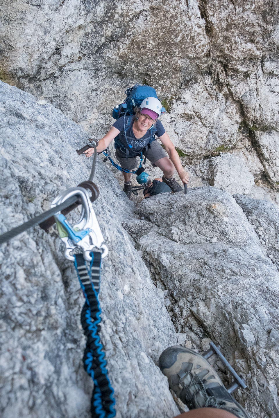
And then we had to climb straight up this short section.


Looking back at a new valley that we'd entered when we rounded that sharp corner.

The town of Kranjska Gora where we spent our first night.


At this point I was beginning to worry that some nearby dark clouds would begin to rain on us, therefore making the rocks more slippery. Thankfully that did not happen.


Vrsic pass (1611m) is the highest pass in Slovenia. It sits between Razor and Sedlo Peaks. The clouds were closing in and time was short so we did not do these optional summit hikes.

It's hard to see the hut but it's right in the center of this photo in Trenta Valley.

Razor Mt is a 1.5 hour intense via feratta climb.

Fifty hairpin bends often on loose scree led us down the long steep slope to the hut.

More Ibex.


Looking back at the slope we'd just descended.

Sunset at the Pogacnik hut (2050m).

Sept. 3: Vrsic-Zadnjica-Kriski Podi
Stats: 8 km / 1000m gain
This was the most challenging exposed day, that involved traversing a cliff.

I came out to check out the early morning sun and got in a fight with the buck. The buck won. He was not backing off and kept butting my leg with his boney forehead.


Looking back at the slope we descended behind the hut the day before.
Judith is helping Thea on a narrow section.


Fissured limestone pavements and hollows of Kriki podi.


Looking back.

Looking at our destinaion; the summit of Bovski Gamsovec is to the right.


One miss step and you fall to certain death. This stretch should've had via ferrata cables but it didn't.

Traversing this sheer cliff on very narrow shleves was pretty scarey. Hooking up to the cable was a must.

A chimney in which we had to go straight up with the help of the iron footholds and pegs to hang onto.

I took this photo from a small landing just 10-minutes below the peak. Judith is taking her final steps to get off of the cliff.


north

The last 10-minutes were a scramble. Thea opted to not do it. A large group of young people were right behind us -- east.

On Mt. Bovski Gamsovec's summit (2391m) -- west.

south

Looking down at the cliff we'd traversed.


We almost lost Thea here. After lunch I headed for the longer zigzag trail to start the descent. But Thea took the short-cut which involved a high step down. Her backpack shifted and she lost her balance. Thankfully she'd grabbed the cable but couldn't hold on much longer. The young lady that was closest to her jumped up and grabbed her. Phew!

This side of the mountain was much less exposed, having a nice dirt trail that wound steeply through grassy slopes.

east


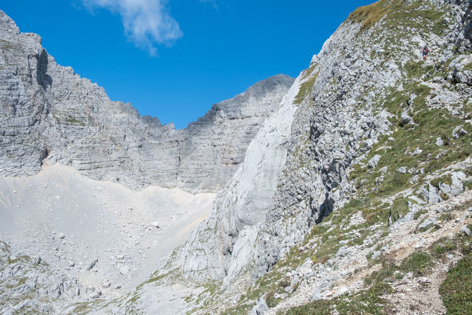

southeast

At the end of the opposite slope, just round the corner the trail began to climb again. The Luknja junction is to the left.

An old mule track.


Carline thistle

The trail continues up towards the hut on an old mule track which is wide and well trod with a more gradual grade so it was not very demanding. For the last 4 days I'd set off on my own for the last few hours and secure a room for the three of us for the night.

The mighty wall of Kanjavec.

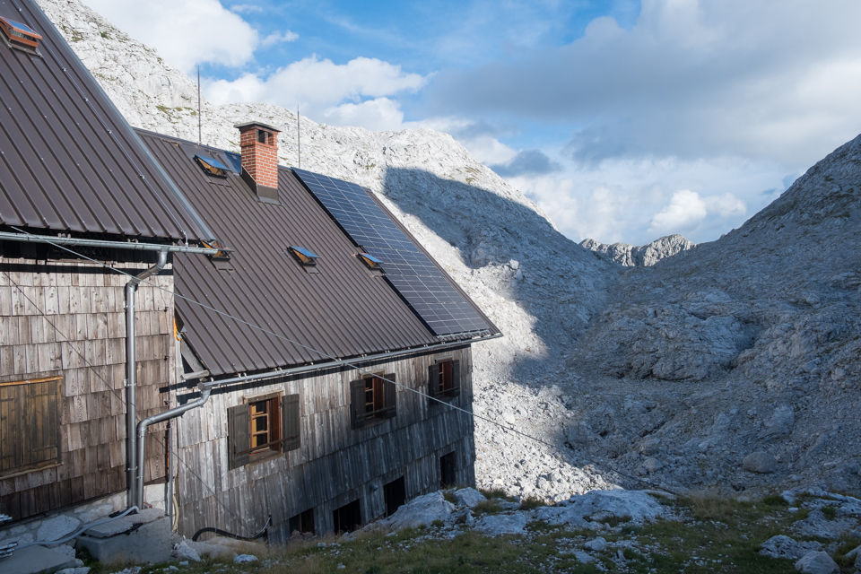
The Triglav hut (2151m) was the highest and the most busy hut because a trail from there leads to the highest mount in the alps, Mt. Triglav. Another trail leads up from the valley floor which is accessible by vehicle. Water was scarce. It cost me 1.7 euros just for a cup of hot water and 2.7E for a small sandwich sized piece of butter! The toilets were enamel squares in the ground with a hole and a bucket of water to flush your waste down the hole with. Rather grim and smelly.

Privacy? Forget it. At least we had the end by the window. Every bed was filled except one beside us. Probably because you'd have to climb over other hikers to get out of it to go pee in the night. It came in very handy for putting our gear on it. Showers after a hot sweaty day? No such thing. Just one sink behind a curtain for about 50 hikers. That luxury we only had at the first & fourth huts which had road access.
Day 4: Dolic to Triglav Lakes Valley
Stats: 8 km / 300m gain
The first half of the trek and the hardest part was now behind us. From here on in, we were staying elevations below 1700m.

Goodbye Mt. Triglav (2863m)

Looking back.


The trail led us southwest to Hribarice saddle (2358m) on the right.

Looking at the pass.
Endangered Kerner Alpine Poppy Mountain Thrift

Some caution was needed due to loose scree.

Looking back -- east.

Zoomed in on Thea by the sink holes.


Leaving the saddle.


A barren rocky landscape. Amazing how a few flowers managed to grow there.
Fairy's Thimble Kerner Poppy


Entering the Triglav Lakes Valley.


Green Lake.


south


Big Lake (Veliko Jezero).


Triglav Valley Lakes hut (1685m) is located by Double Lake.
Day 5: Triglav Lakes Valley to Krn Lakes
Stats: 12 km 300m gain

Leaving Double Lake.
Monkshood St. Johnswort


Willow Gentian

Mountain Ash

Dwarf pine trees in karst country.
Squarrose Knapweed Ox EAutumn Crocusye

The Bogatinom hut was originally used as a hospital in WW1. From there to the next hut the route went from east to west.

Autumn Crocus Grass of Parnassus


At Bogatin saddle (1800m).


Former Italian military barrack ruins from 1930.

Looking back at dark approaching clouds.

Fringed Gentian


Krnskih Lake Hut (1385m).
Day 6: Krn Lakes to Planina Kuhinja
Stats: 8 km / 1000m gain / 1250m descent
I think they had a faulty itineray on this day. The last shuttle was to pick us up at 3:00pm. But it was a 6.5-7 hour moving time day. That meant no time to take longer breaks. I ended up injuring my knee in my haste to get down and ask the driver to wait for the other two women.

We just had to get a shot with Alison from Brisban, Australia in it. She started when we did and hiked exactly the same route as us. We'd usually shared breakfast and dinner tables with her in the huts.
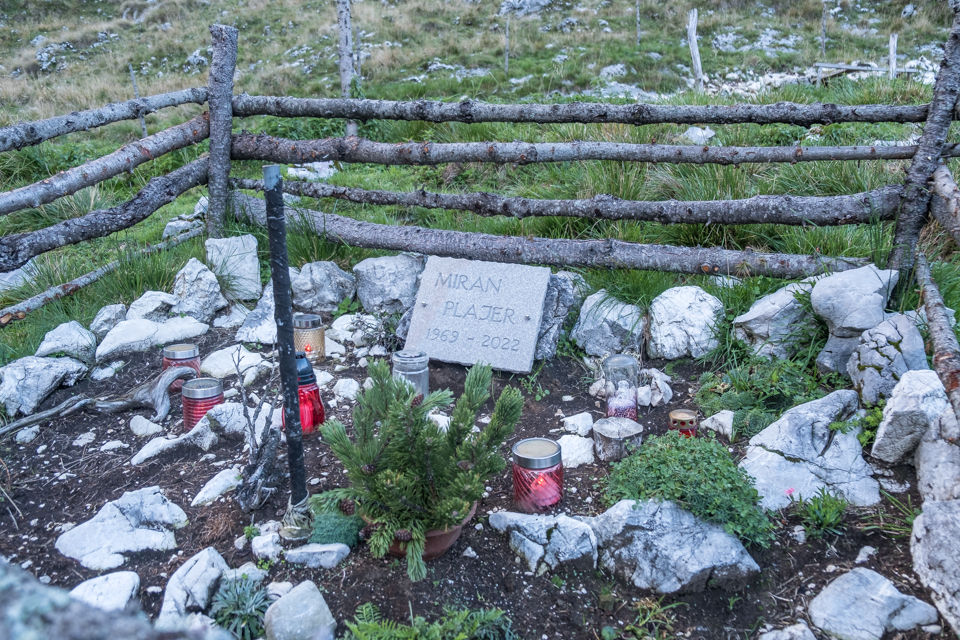
Burning candles by this lonely gravesite.

Krn Lake is Slovenia's largest mountain lake. It is 300m long, 150m wide, 18m deep & 1391m high.
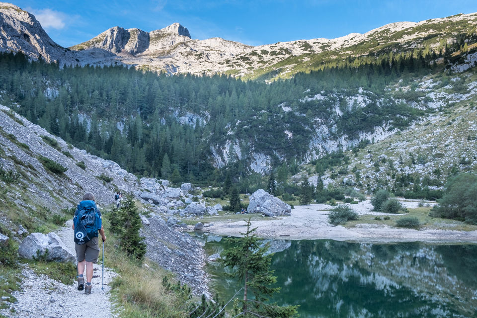


A hunter's lodge.

Destination in sight. The summit of Mt. Krn viewed through the clouds.
Weeping Bolete Alpine Plantain

A steep rocky climb to Krnska Skrbina saddle (2058m).

Leaving the valley.

Looking back.


WW1 relics at the Krnska Skrbina saddle are a testimony of the bloody events of the Isonzo front and the dark period of the Rapallo border.


The final ascent from the pass to Mt. Krn summit.


Thea stayed by this hut while Judith and I summited.

Krn Mt. summit (2244m).
360 degree views from the summit.

Why did they post a 3:00pm shuttle pickup when they knew the day required 6 to 7 hours hiking moving time? So I went ahead on the steep long desent, with a plan to ask the driver to wait for the other two. I dropped 1250m down a steep rocky slope with a 30 pound backpack in only 1.5 hours. I got there with 1:50 hours to spare. The next few days I had a very swollen knee. The kind stewardess on the airplane gave me ice packs to ease the pain and bring down the swelling.


Horse Mint
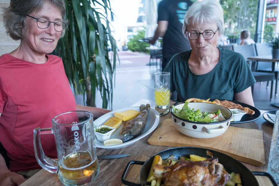
Back in civilization. What a delicious meal. We stayed in Tolmin overnight. Menus on the trek were very limited. The most common dishes served on the trek were Kranjska klobasa which is pork sausage served with potatoes and sour cabbage, zganci (hard boiled corn mush) and jota, barley soup which was more like stew. White bread + eggs for breakfast and dessert was apple strudel or chocolate pudding.
to be continued in part 2...


Comments