Paleface Mt.
- Jocelyn Timmermans

- Oct 12, 2024
- 3 min read
Oct. 10, 2024 -- Chilliwack Lake Provincial Park
Stats: 10.5 km / 680m gain / 1823m high / 5:10 hours MT
Sheesh. Had I known it'd be that bad, I wouldn't have posted it. Why did it take us so long (9:45am - 5:30pm) to do a hike with such moderate stats? I hesitate to call this a hike. The route didn't even show up on my Garmin66i! It did on AllTrails, otherwise we wouldn't have found it. This day involved ploughing through wet brush & alders that were almost taller than we were. After an hour of that, I figured the trail would get better upon entering the forest. But it didn't. Thanks Mary, for putting those yellow flagging tapes up. We intermittently had to negotiate three big boulder fields between forest, where the rocks were covered in moist moss and therefore slippery. Higher up they even got frosty, being on a north-facing slope that didn't see much sun. Add to that, the very steep rock gully. It was only the last half-an-hour that felt like a walk in the park after what we'd just done, even though the "trail" looked more like an animal trail. But once on top, with all of Chilliwack Lake below us and umpteen peaks surrounding us on all sides, the efforts paid off. We almost forgot about the awful journey to get there -- but not quite.
We drove to the TCT trailhead, marked by Mary with 3 flagging tapes. This cut 3.5 km off of the route, one way. Hence the AllTrails stats numbers being so much higher.
Coral Bitter Bolete

Allana's face says it all. She's looking up at those boulder fields, after having pushed her way through a dense thicket of brush.


Regrouping at the other side of the old cut-block. A soggy and relieved-to-out-of-there-bunch.


We crossed this first boulder field, staying lower to get back into the trees.

There was only one way to cross here: slowly and extremely carefully, making sure each step is secured before taking the next one.

After the forest section, we clambered up another boulder field where Iraj & Gregg turned left for 5-minutes, to get onto the forest trail that ran parallel to the very steep rock gully (as directed by AllTrails). But the crossing looked too sketchy so the rest of us stayed in the gully. The last third of the gully was frosty, it being on a north-facing slope so it was not getting the sun. We saw some flagging tapes about 2/3 up the gully, so did a bit of a left which was not good. The rocks were gone but replaced with very slippery moss and mud. Hanging on to branches was our only way of getting up there. Needless to say, we stuck to the gully on the descent.

This is where I put on my micro-spikes. But most of the group hadn't brought them.

Realizing we were going too high again, three of the group carried on, having to negotiate a very steep rocky bluff before reaching the summit. The rest of us dropped down for 5-minutes and go into this very welcome flat dry meadow. Phew.

The route did a big horseshoe to get round the cliff wall.


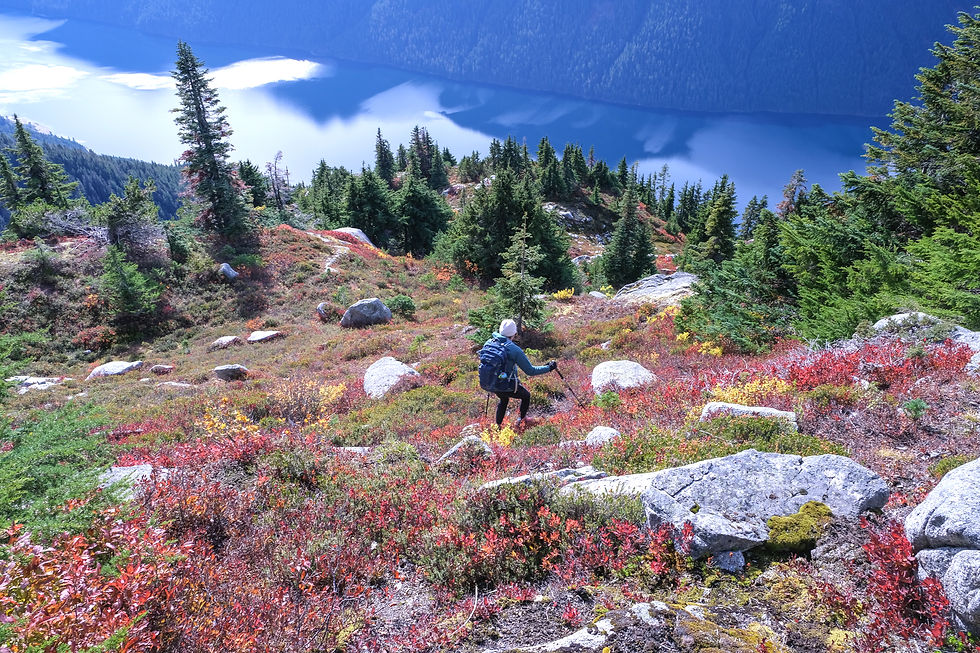
Just before the summit we got these entire views of Chilliwack Lake, lined with Lindeman, MacDonald & Webb Peaks -- west.
above 2 photos are south to northwest

Wow wee! Made it.

Foley (2160m) + Williams Peaks (1980m) -- northwest.

east

southeast

southwest

I had warned everyone that we couldn't stay longer than half-an-hour. We'd arrived at 2:00pm.

Group shot minus Sue A who took this photo: back row. left to right; Michelle K, Bote M, Allana W, Charlotte H, Gregg S, Susan V, Iraj F
Front row: me, Lonja B, Denise D, Lori Y + Ingrid F
Also minus Terry B, Paul L & Case T who made it to the rock gully and then had the good sense to turn back.

Iraj renamed this mountain to the "F***n" Mountain.

At the base of our lunch rock was this pretty tarn.

Time to go. It was hard to tear the two Susans away from such splendor.


We regrouped back in the meadow. From there we stayed a tight group, as it was too easy to get lost.

Back at the top of the rock gully. By now I was hearing more moans and groans from the group. But also laughter at the craziness of it all. We were tired and so ready to be done. It was 5:30pm before we got back to the 4WDs.

The TCT trail continues north (the grey line in the upper middle of this map).

During the descent, after the rock gully we stayed lower on the boulder field which proved to be the better way to go (where you see the loop).


Comments